Top 8 Apps For Marine Navigation (Judged By A Navigator)
Having spent the last 10 years using sophisticated ECDIS systems on commercial ships, I was curious as to whether I could have a similar experience on my own boat, using just a tablet and a mobile phone.
It quickly became apparent that there were plenty of potential apps that might be able to live up to the challenge.
In the end, I decided to buy 8 of the best, so that I could independently put them to the test, and ultimately compare them to find the best.
I must say, overall I was pleasantly surprised, but I was able to find a winner.
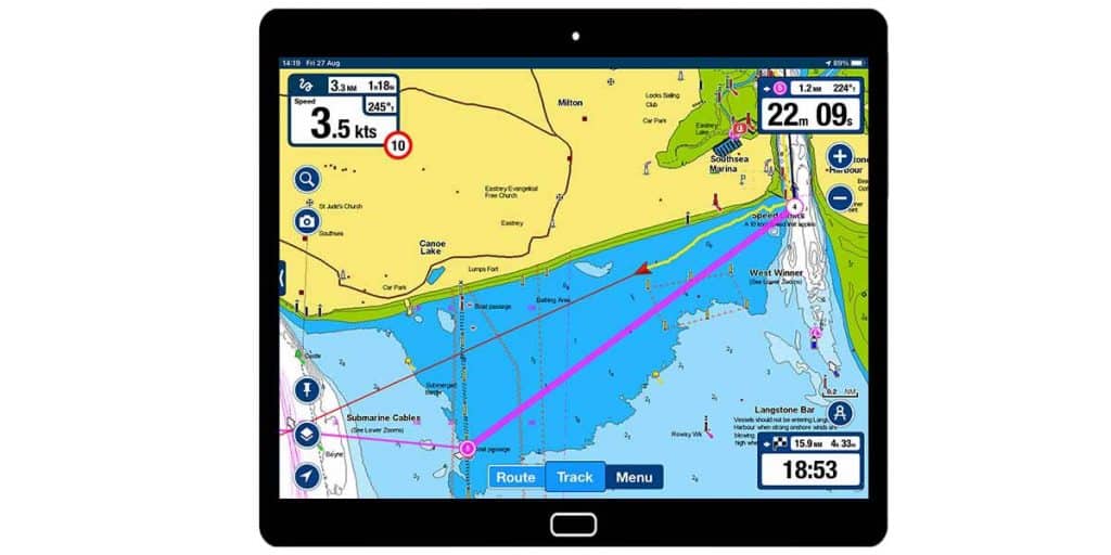
Navionics (Overall Winner)
iOS & Android
Cost: Free app, with in-app purchases for charts. Chart subscriptions include advanced app features.
Navionics is probably the most popular boating app, and for good reason. Chart subscriptions include access to all of the app’s features like route monitoring, currents & tides, NMEA integration, data overlays and additional unique features like community edits, which are only possible due to its immense popularity.
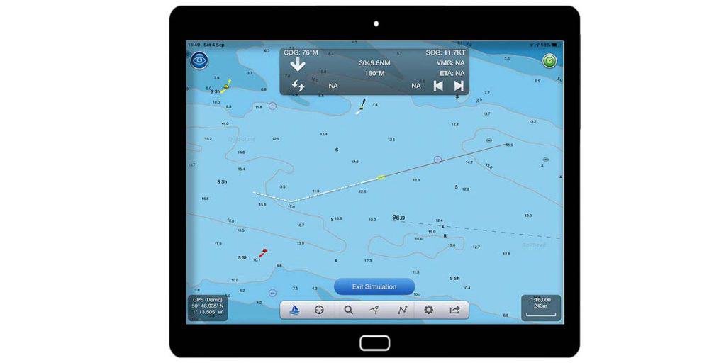
The navigation experience is very pleasant and has clearly been well optimised for use by recreational boaters. You get just the right amount of information around the screen, displayed in a very unobtrusive way.
The main weakness with Navionics is its lack of customisation options in comparison to other apps. Given the obvious thought that has gone into its design, however, you won’t feel like you need to change anything.
Click here to read my full Navionics review.
iSailor (Very Close Second)

iOS & Android
Cost: Free app, with in-app purchases for charts and advanced features.
iSailor is the most advanced marine navigational app, with professional-level features included as standard. For example, when passage planning, iSailor was the only app that gave full control over cross-track-distance (XTD) and turn radius on waypoints.
The navigation experience is fantastic, with an optional pull-out at the side of the screen containing all the relevant data you would need for a passage.
The main weakness with iSailor was the additional in-app purchases required to activate all of its features. If you want to add every feature, the app can quickly become very expensive.
Click here to read my full iSailor review.
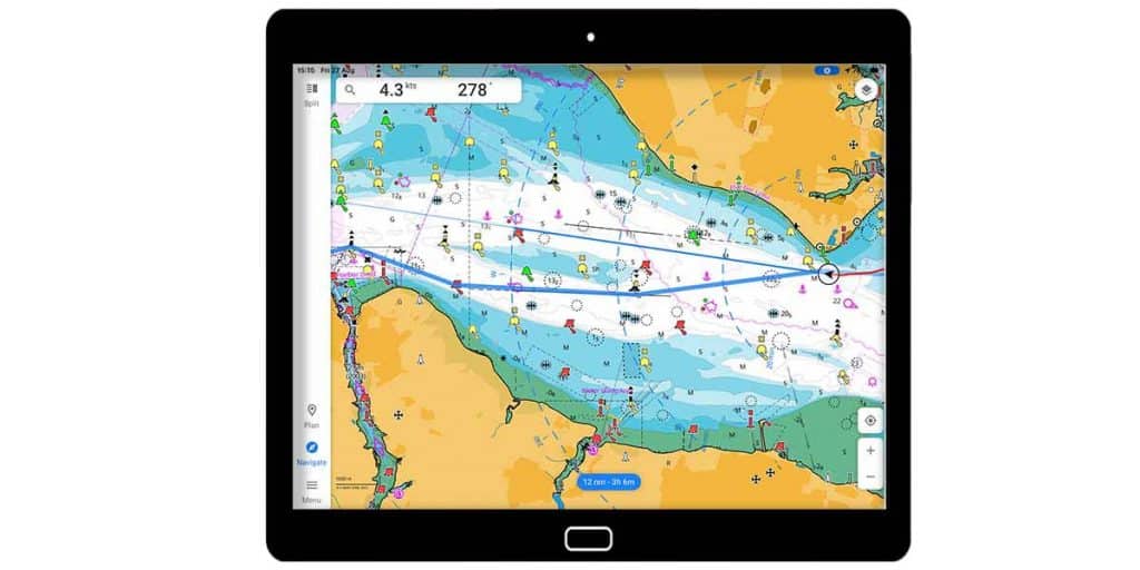
C-Map (Best Worldwide Value)
iOS & Android
Cost: Free app, with an in-app purchase to save charts to your device and activate Premium features.
C-Map is the best value charting application for worldwide use. With an internet connection, you can access worldwide charts for free, then a single in-app purchase will activate Premium features so that you can download up to 1000 charts to your device.
Navigation with C-Map is great because there is excellent chart customisation, and it is incredibly intuitive to create and follow routes. It also felt strangely familiar, having used the same charts on passenger ships. The C-Map app is a great translation of their commercial product to the pleasure boating market.
The main weakness with C-Map is that navigational information on the screen can be hard to read, especially if you are only using a small tablet.
Click here to read my full C-Map review.
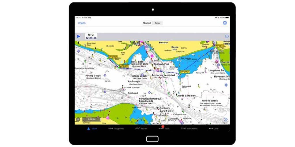
iNavX (Most Comprehensive)
iOS & Android
Cost: Free app on Android (paid on iOS), with in-app purchases for charts. US charts are free.
iNavX is the most customisable navigational app and the only one that I tested that is capable of displaying almost every NMEA data type imaginable.
Users in the US will be able to find free NOAA charts, but the rest of the world will need to use the in-app store to buy local charts. iNavX offers a vast choice of charts, easily eclipsing its competition in terms of variety.
The extensive customisation makes navigating with iNavX a fantastic experience, although it can take a while to get it looking how you want.
The main weakness with iNavX is its complexity. Performing simple actions is a lot more complicated than in other apps. With regular use though, you would become familiar with it and find it quick and easy.
Click here to read my full iNavX review.
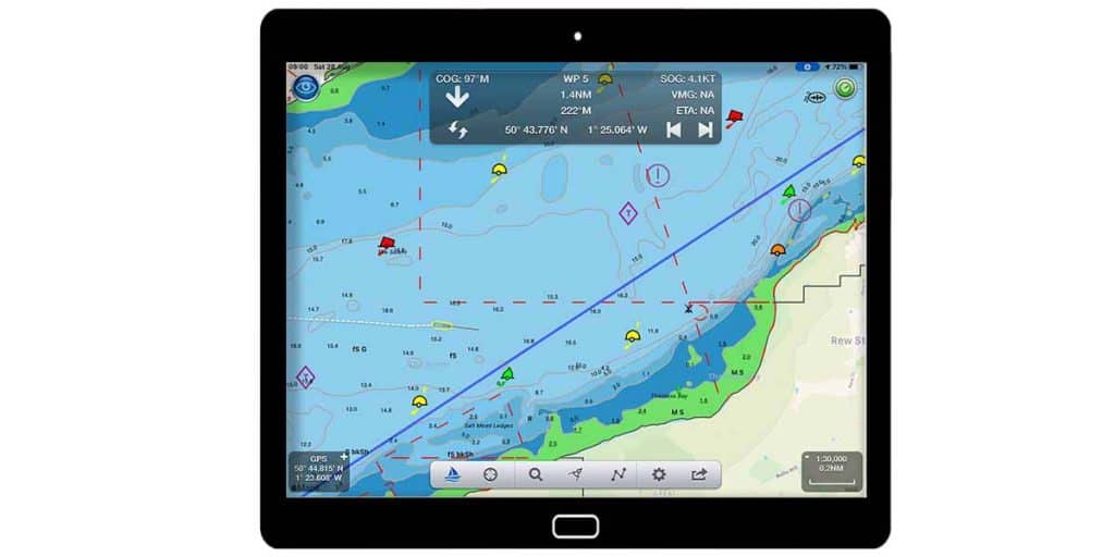
Seapilot

iOS & Android
Cost: Free basic app, with an in-app purchase for the Premium app. Charts are available as additional in-app purchases.
Seapilot is a comprehensive marine navigation app, providing a whole range of different capabilities in its Premium version.
The charts look great and have some of the best shadings out of all the apps I tested. You will find scrolling around them is a seamless experience, without overwhelming and distracting data.
The navigation screen is customisable, so you can display most of the data you need in an overlay at the top.
Its main weakness is that it does not display all the data that you need on the main screen, so you will need to open the side menus to get at everything you need.
Click here to read my full Seapilot review.
SeaNav
iOS Only
Cost: Free app, with in-app purchases for charts and advanced features.
SeaNav pushes the boundaries of mobile technology with innovative features like its Augmented Reality view, helping you to identify charted navigational features and other vessels in your vicinity.
Its navigation screen is simple, and easily customisable, with plenty of control over the layers that you select on your chart.
The main weakness with SeaNav is that your own boat is quite hard to see on the chart due to its small size and lack of contrast. The same issue applies to the text, although the contrast is much better due to its dark underlay.
Click here to read my full SeaNav review.
NavLink
iOS Only
Cost: Free app, with in-app purchases for charts and advanced features. Alternatively, you can purchase the UK or US version of the app which comes will charts and additional features.
NavLink is Digital Yacht’s navigation app, which makes full use of advanced features such as its Augmented Reality view.
Its navigation screen is unobstructed, giving a clear view of charted features which are all controllable through an extensive layer selection menu.
The main weakness with NavLink is there is minimal contrast between your own vessel and the underlying chart, making it hard to see, especially in bright light. The same issue applies to text around the screen, albeit to a lesser extent due to its dark underlay.
Click here to read my full NavLink review.
Memory Map (Best For Non-Sailors)
iOS & Android
Cost: Free app, with in-app purchases for maps.
Memory Map is a fantastic raster chart app, capable of displaying nautical charts as well as USGS and OS maps. As such, it is a top choice for users wishing to explore their coastline on foot as well as by boat.
In navigation mode, Memory Map will feel familiar for anyone used to navigating on paper charts as it literally places a digital position fix on an image of a traditional paper chart.
Memory Map’s main weakness is that it uses raster charts, which are not well optimised for digital use. Essential navigational information is not always visible because notes on the chart will be beyond the edge of the screen.
Click here to read my full Memory Map review.
Comparing Top Marine Navigation Apps By Price
Winner: iSailor
The easiest comparison to make between the top marine navigation apps is their price.
Unfortunately, it is not quite as simple as it seems. Each app has a different pricing structure.
Some charge for the app, and others charge only for the charts. Often different features cost more as well.
In the end, I decided to just add up what I spent on each app. I shopped in the app stores and purchased each one for a pre-planned sailing trip on the South Coast of the UK.
I did not need any extra features and did not want to go shopping around for discount codes.
I wanted to have cross-platform functionality between my iPad and Android phone, but I was not willing to spend extra to get it.
| App | App Cost | Chart Cost | Total Cost |
|---|---|---|---|
| iSailor | 0 | 13.99 | 13.99 |
| SeaNav | 0 | 19.99 | 19.99 |
| NavLink | 30.99 | 0 | 30.99 |
| Memory Map | 0 | 24.99 | 24.99 |
| Navionics | 0 | 34.99 | 34.99 |
| C-Map | 0 | 42.99 | 42.99 |
| Seapilot | 29.99 | 17.49 | 47.48 |
| iNavX | 4.99 | 83.99 | 88.98 |
iSailor came out on top in terms of price, however, that is primarily because their pricing structure means they charge you extra for each feature within the app.
Other apps include more features within their base cost, but I did not factor that in on this crude comparison of cost per app.
It should also be noted that apps like iNavX may perform better in the USA where charts might be available for free. For me though, I can only compare based on what I spent.
Comparing Top Marine Navigation Apps For Charts
Winner: iNavX
The primary function of a marine navigational app is to display digital versions of maritime charts to assist a user in navigation.
We could compare how each chart performed based on some statistics, but primarily it is about that feeling while using the app itself.
Do the charts feel good when you are scrolling around them, and does that translate into a safer navigational experience for the user?
Therefore, I decided to compare the type of chart, customisation available, and a “feeling” rank for how safe it felt to me based on my industry experience.
| App | Type | Customisation | Feeling |
|---|---|---|---|
| iNavX | Both | Min | Good |
| C-Map | Vector | Max | Good |
| Seapilot | Vector | Med | Good |
| iSailor | Vector | Med | Good |
| Navionics | Vector | Min | Good |
| SeaNav | Vector | Max | OK |
| NavLink | Vector | Max | OK |
| Memory Map | Raster | None | Good |
The overall winner for charts was iNavX, simply because their chart store allows you to purchase charts from a number of different providers.
For example, you could purchase C-Map or Navionics charts within iNavX if you wanted to.
Customisation between the apps varied considerably, however, more customisation is not necessarily a good thing.
The important thing with marine navigational apps is to be able to clearly see all the information on the screen.
When the screen gets too cluttered, it is nice to be able to customise more layers to make the most important information easy to see.
The apps with less customisation never actually felt too cluttered anyway. I could confidently say that each app does have enough customisation for its own performance.
As for the feeling, most of them felt good and safe to use. The reason that SeaNav and Navlink are rated lower is that both of them felt like they were missing information when I ran the apps.
In both cases, after some tweaking, I did become more comfortable using them, but my first impression was that the charts looked a little sparse. I found it hard to shake that first impression during my test.
In addition to that, SeaNav and NavLink both had the slowest loading charts.
Overall though, all apps did perform well.
In terms of comparing the different charts, it was just about finding the rather minimal differences between 8 good choices.
Comparing Top Marine Navigation Apps For Passage Planning
Winner: iSailor
To efficiently use a marine navigation app, one of the crucial first steps is planning your passage.
Most of the apps perform the process in the same way, with some offering additional controls over some elements of passage planning.
In the end, I decided to compare how easy it was to complete the passage plan, and what sort of features were included.
| App | Difficulty | Features |
|---|---|---|
| iSailor | Medium | Advanced |
| Seapilot | Easy | Basic |
| Navionics | Easy | Basic |
| NavLink | Easy | Basic |
| SeaNav | Easy | Basic |
| C-Map | Easy | Basic |
| Memory Map | Easy | Basic |
| iNavX | Hard | Basic |
In the end, most of the apps performed passage planning in a comparable way.
The stand out winner, however, was iSailor. In iSailor, you get advanced features such as XTD (cross-track-distance) and turn radius, to precisely control your routes.
Admittedly, these are not features that will be used by most users, but they are enough to allow iSailor to clinch the top spot in terms of passage planning.
Seapilot is then slightly above the rest because it offsets the position of waypoints from the position you tap on the screen. This allows you to precisely place the waypoint as you are not blocking your view with your finger.
In last position was iNavX because it was the most complicated for passage planning. All the rest of them allow you to tap along your route to create a series of waypoints. iNavX gets you to first create the waypoints, then pick them from a list to make your route.
For me, there were just too many steps in the process for it to be an efficient way of planning passages.
Comparing Top Marine Navigation Apps For Navigation Ability
Winner: Navionics
The primary purpose of a marine navigation app is to use it for navigation. I want it to clearly show me my position on a chart, along with supplementary information that would be useful for my passage.
To compare the apps for navigation, I rated the visibility of your own vessel as well as additional useful information around the edge of the screen.
| App | Own Vessel | Additional Data |
|---|---|---|
| Navionics | Clear | All |
| iSailor | Clear | Almost All |
| C-Map | Clear | Most |
| Seapilot | Clear | Most |
| iNavX | Clear | Most |
| NavLink | Hard to see | Most |
| SeaNav | Hard to see | Most |
| Memory Map | Clear | Some |
The stand-out winner was Navionics because the app displayed my own vessel clearly, as well as all the essential information around the edge of the screen.
iSailor was a close second place, with the main difference between the two being that iSailor displays all the relevant data on a sidebar which takes up some chart space. Navionics places the relevant data in the corners of the screen instead.
Most of the other apps require you to open an additional menu to see some of the data that I would deem to be essential. The extra interaction became a bit of a distraction when I was trying to navigate.
Comparing Top Marine Navigation Apps By Features
Winner: Navionics
While not strictly necessary, extra features are a great distinguishing factor between different marine navigation apps.
I did not buy any app for their extra features, but I understand other users will be likely to use them.
I decided to compare whether each app offered NMEA connectivity, as well as my overall impression of the additional features based on my experience with the app.
| App | NMEA | Other Features |
|---|---|---|
| Navionics | Yes | All included in the base price |
| iSailor | Yes | All available as in-app purchases |
| Seapilot | Yes | Internet AIS as standard |
| iNavX | Yes (Best) | Complicated |
| NavLink | Yes | OK |
| SeaNav | Yes | OK |
| C-Map | No | Not many extras |
| Memory Map | No | Not many extras |
The overall winner in terms of features was Navionics. When I subscribed to my local chart area, all features (like tides, currents & weather) were activated as standard.
I found that when the app just gave them to me, I did use them and I did enjoy using them.
iSailor was second because it offers similar features to Navionics, but as additional in-app purchases.
iNavX deserves a special mention because its NMEA interface is the best out of all the apps. It allows you to display almost every possible instrument feed, in-app. The only reason it did not rank higher was its extensive feature set adds a lot of complexity, making the app harder to use.
Comparing Top Marine Navigation Apps By Usability
Winner: Navionics
My final comparison between marine navigation apps was to determine how user-friendly the app is.
To undertake this test, I attempted to do everything in each app without consulting the user manual.
I wanted to know how many features I would be able to find, and how easy I would find using them.
To compare, I decided to give each app a difficulty rating out of 10, with 10 meaning that the app was fully intuitive and optimised for my use, and 0 meaning I could not work out anything in the app.
Ratings are also based on comparison with other apps, just to distinguish which are harder and which are easier to use.
| App | Rating |
|---|---|
| Navionics | 10 |
| iSailor | 9 |
| Seapilot | 8 |
| NavLink | 7 |
| SeaNav | 7 |
| C-Map | 7 |
| Memory Map | 6 |
| iNavX | 5 |
Again, the overall winner was Navionics. It was simple to use, and I discovered a lot of features that I was able to fully use, without needing to look at any of its documentation.
iSailor was a close second place but narrowly beaten because I kept making the same mistake when passage planning. I kept clicking “route complete” when I was trying to “add waypoint”. The user-friendliness of the rest of the app made me place it high in my ranking.
The rest were all very close and overall were very simple to use. The differences were minor and came from trying to discover different features, toggle chart layers etc.
iNavX was the most difficult one to use and was the only one where I needed to consult the user manual. It was mainly because of the way it makes you place waypoints, then create a route by selecting waypoints from a list.
I used to do that on old GPS systems, but on modern charts I have always just clicked along the route, scanning it for dangers as you go.
Overall though, by the end of the testing, I could use all of the apps reasonably confidently.
No matter which app you choose, as long as you practise with it regularly, you will find it easy to use.