Top 5 Marine Navigation Apps For Android
If you own a boat, and an Android phone or tablet, there is a good chance you have come across marine navigation apps in Google’s Play Store.
There are a lot of them to look through, so to save you considerable time and energy I have compiled a list of my top 5.
- Navionics (Overall Winner)
- iSailor (Very Close Second)
- C-Map (Best Worldwide Value)
- iNavX (Most Comprehensive)
- Seapilot
Naturally, the top apps for Android are actually the same as the top apps for iOS, and they all feature in my list of the Top 8 Marine Navigation Apps.
During my testing, it became apparent that the best and most popular ones are available cross-platform, presumably so that they reach the widest possible audience.
I tested a few that are specific to Android, but I found that none of them could compete with the ones on this list.
Navionics
Cost: Free app, with in-app purchases for charts. Chart subscriptions include advanced app features.
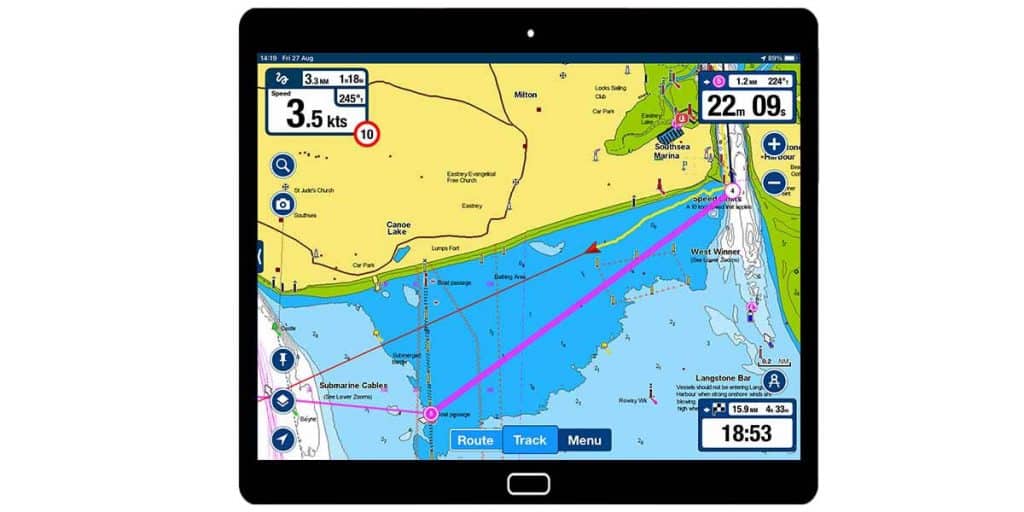
Well designed and reasonably priced, Navionics was the overall winner in my tests. It was clear why this is the most popular boating app, with 1,000,000+ downloads from the Play Store.
The app includes features like route planning & monitoring, currents & tides, NMEA integration and unique data overlays.
The vast Navionics community contributes edits to their charts, giving an extra dimension to your sailing experience through local knowledge.
Navigating using Navionics an easy and intuitive, and has clearly been optimised for use by recreational boaters.
I was particularly impressed with the way Navionics displays just the right amount of information around the edge of the screen in a very unobtrusive way.
Its main weakness is that there are fewer customisations available in comparison to other apps. Given the design of Navionics, however, you probably won’t feel like you need to customise anything anyway.
Read my full Navionics review: Navionics App: Reviewed By A Professional Navigator
iSailor
Cost: Free app, with in-app purchases for charts and advanced features.

Created by Transas (now Wärtsilä), iSailor is based on one of the most popular commercial navigation systems. The app itself is very popular in the Play Store, with over 100,000 downloads.
iSailor was probably the most advanced app that I tested, with passage planning features including cross-track-distance (XTD) and turn radius available as standard.
Navigating with iSailor is great, with its sliding sidebar to display all the navigational information you need for your passage.
The main weakness with iSailor on Android is that it requires a modern phone to be able to download.
Read my full iSailor review: iSailor: Reviewed By A Professional Navigator.
C-Map
Cost: Free app, with an in-app purchase to save charts to your device and activate Premium features.
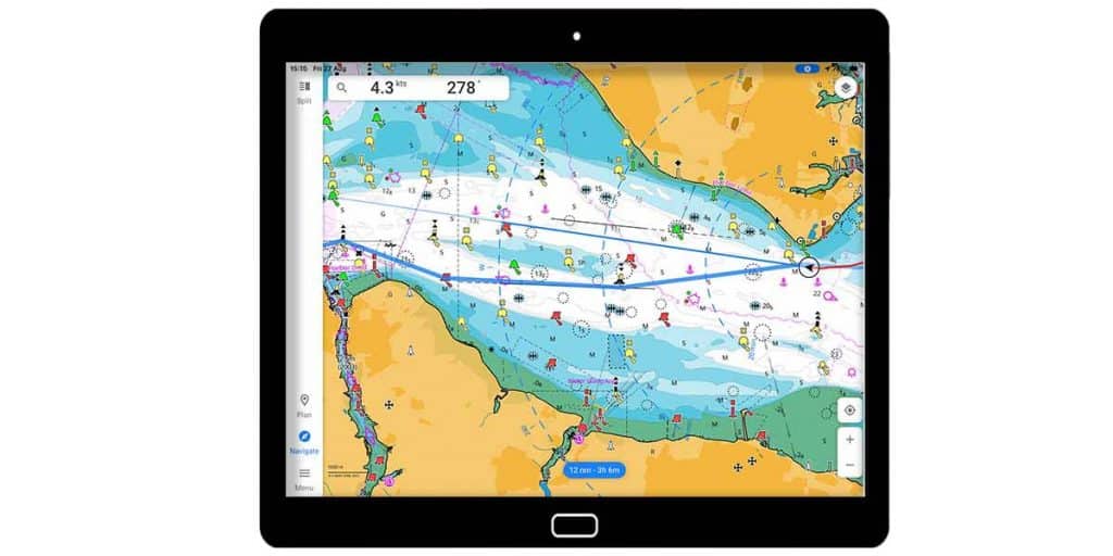
Recognised across the industry, the C-Map app is a great adaptation of an already successful commercial navigation system.
The app itself is incredibly popular, with over 500,000 downloads from the Play Store.
C-Map uniquely offers free worldwide charts, as long as you have an internet connection. Once you activate Premium, you gain the ability to download up to 1000 charts to your device.
Chart customisation in C-Map is brilliant, with a vast array of layer controls. You can instantly de-clutter the screen if it starts to look busy.
Navigation in C-Map is incredibly easy, with intuitive manual or automatic route creation and a simple way of following your track.
C-Map’s main weakness is that some navigational information can be hard to read on the screen, especially if you are using a small tablet.
Read my full C-Map review: C-Map: Reviewed By A Professional Navigator.
iNavX
Cost: Free app, with in-app purchases for charts. US charts are free.
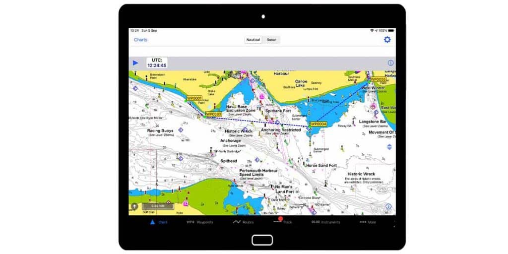
With over 100,000 downloads from the Play Store, iNavX is a popular app, and easily the most customisable one that I tested.
iNavX is capable of drawing on almost every NMEA data type imaginable and displaying it directly on your navigational screen.
Users in the US can benefit from free raster charts from NOAA, and everyone else will get access to easily the most extensive app-based chart store. iNavX can run charts from many different providers.
The navigation experience within iNavX is very much subject to the customisations you make. As you gain experience with the app, you’ll find navigation easy and fun.
The main weakness of iNavX is its complexity because even simple actions seem more complicated than they do in other apps. With regular use, however, you will grow to love iNavX.
Read my full iNavX review: iNavX: Reviewed By A Professional Navigator.
Seapilot
Cost: Free basic app, with an in-app purchase for the Premium app. Charts are available as additional in-app purchases.

One of my favourite apps on test, Seapilot from Raymarine is a popular boating app with over 100,000 downloads from the Play Store.
The charts in Seapilot were the closest match to the commercial systems that I am used to, making the entire app feel very familiar.
Its menu system gives you access to a whole range of controls, and its customisable navigation screen places the data you need in easy sight.
The main weakness with Seapilot is that it feels a bit more like a computer program rather than an app. The menu system, while functional, is not the most efficient for use in a touch screen device.
Read my full Seapilot review: Seapilot: Reviewed By A Professional Navigator.
What To Look For With Android Marine Navigation Apps
If you are considering purchasing a marine navigation app for Android, there are a few things you should look out for.
Check compatibility with your devices
Android is different to iOS in that there is a huge variance in the versions of Android that are prevalent in the community.
Over time, marine navigation apps get updated and no longer work on older versions of Android. This is especially true with navigation apps that use modern features on phones.
I found that some apps would not even load on my phone, despite only being 2 years old.
Check the total price
All marine navigation apps have a different pricing structure. Most of them will offer a free app, then charge you for the charts.
You can check their websites to find out the price that you can expect to pay for charts before you become attached to an app.
Check compatibility
Some people will use their app as a stand-alone device, using the phone’s internal GPS. Others will want to integrate with their boat’s NMEA network.
Not all apps offer full NMEA connectivity. Be sure to check the app that you are considering.
Form your own opinion
After testing so many different apps, I couldn’t believe how different my view was compared to other reviews that I had read.
Most apps offer a free trial, so make use of it and put a few to the test yourself.